Mirador de El Tacorón (Highway HI-410) – located in the southern part of the island (toward Playa de Tacorón), is one of many spots at El Hierro that offer panoramic views of the island. The waters within this area are among the most beautiful anywhere in EL Hierro.
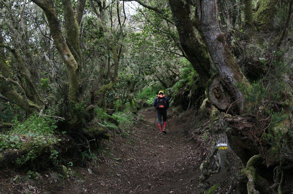
Mencáfete Reserve (Frontera Rural Park) — within the Frontera Rural Park and near Sabinosa is the Mencáfete Integral Nature Reserve. A place that looks enchanted because of its characteristic, humid juniper forest. The wanderer can discover the greenery of the mountains and laurisilva of El Hierro and—in its caves and other areas—endemic species in danger […]
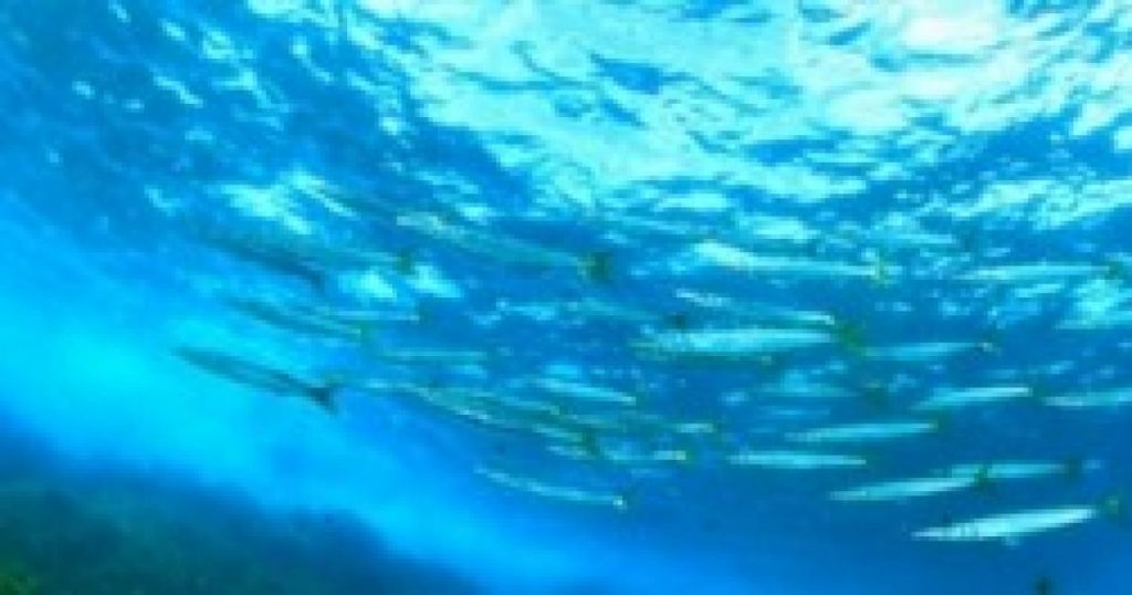
Mar de Las Calmas Marine Reserve (La Restinga) — located on the southern coast of Frontera Rural Park is La Restinga’s Mar de Las Calmas Marine Reserve. This 750-hectares of deep blue water is the richest marine area in El Hierro. As such, it became a haven for scuba divers and underwater photographers. Tourists visiting […]
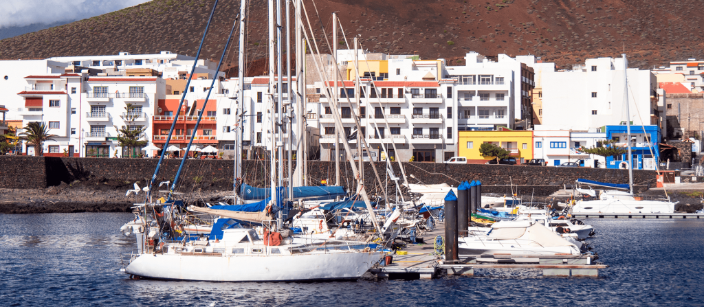
La Restinga (town) — La Restinga is a fishing village located at the southernmost tip of El Hierro and all of Spain. The basic points of interest of this town are the variation of its seabed and the quiet of its streets and coves. A perfect space for anyone who wants to relax on a […]
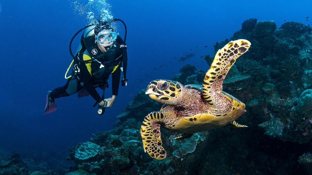
La Restinga (diving) — Once a sleepy fishing village, La Restinga is now becoming a tourist hotspot for divers wanting to experience the warm, still waters of the Mar de las Calmas on the southwestern shore. But be warned, divers must stay near sea level for at least 12 hours after a dive due to […]
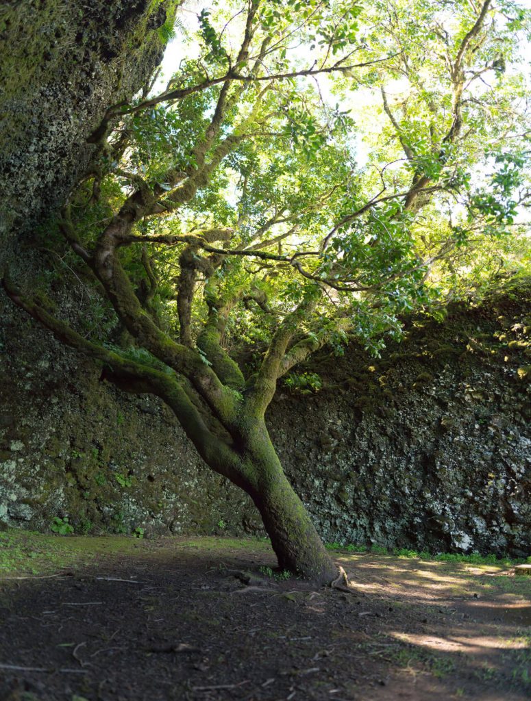
Garoé Tree (Sendero Pre H-11 Km 8, 38915 San Andrés) — in the Berber language, Garoé me the Garoé Tree or Holy Tree is a clear example of the constant pursuit of the local inhabitants of water supplies. The Garoé is the symbol of the island. It condenses the water from the Trade Winds and […]
El Mocanal (town) — this is the most densely populated small town on the north side of the island. The church dates back to the 15th century and is devoted to St. Peter. This is really a highly agricultural hamlet that still maintains areas of old-world charm. El Mocanal is the second town in terms […]
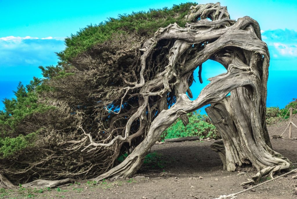
El Hierro Sabinar (Diseminado Dehesas las Cm, 2, 38912 Frontera) – this is a magical open forest that looks straight-out of fairytale books. This forest has incredible centuries-old trees whose ability to adapt to the elements of nature and time often leaves visitors in awe. These gnarled trees look as if they bent to shield […]
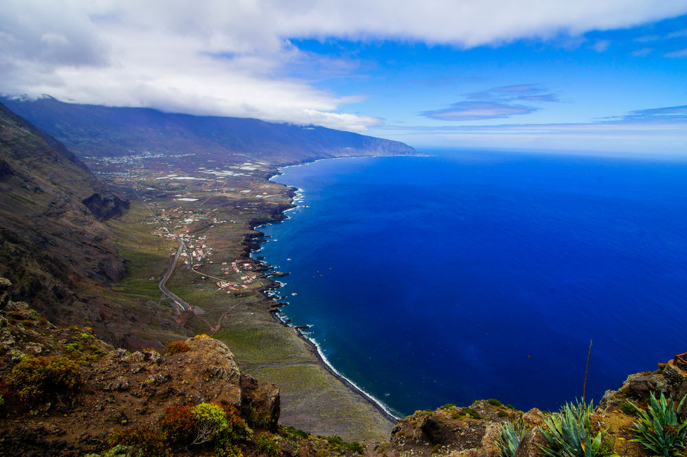
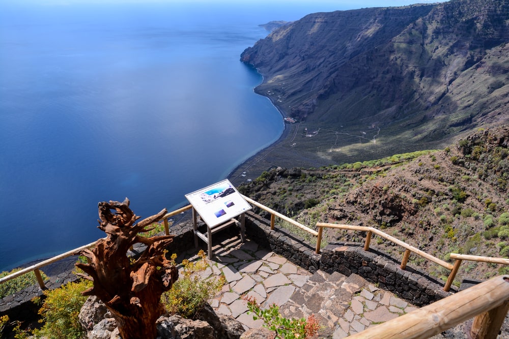
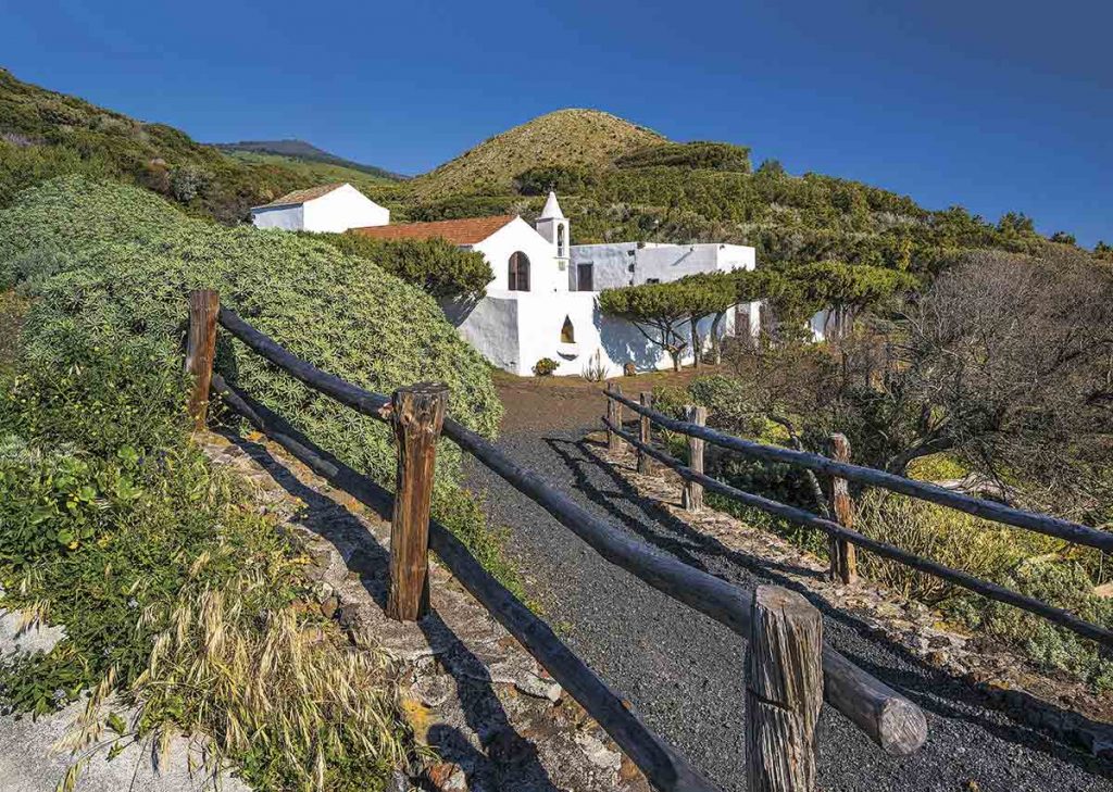
El Golfo (northwest coast of El Hierro) – this vast area is an enormous natural amphitheater, encircled by 3,000 ft-high escarpments and filled with family allotments, slumbering white-washed villages and plantations bursting with pineapple, mango and banana. El Golfo is home to several settlements. Frontera and Sabinosa are the largest, while Los Llanillos, Merese, Toscas, […]
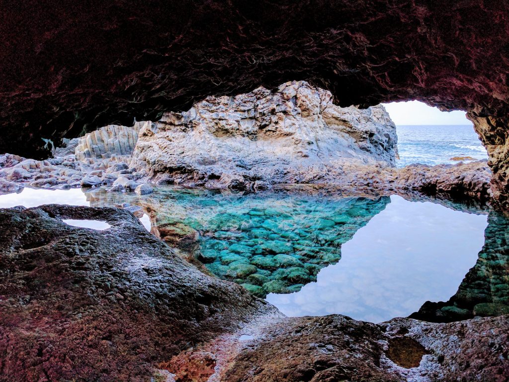
Charco Azul (La Frontera, Los Llanillos) – located off highway HI-551 (19 km. southeast of Villa de Valverde), Charco Azul (“Blue Pool”) wasn’t, in fact, designed by famous Canarian artist César Manrique (as rumored), but is a magnificent work of art in its own right. Charco Azul is, without doubt, one of the most spectacular […]